
Search a Keller Street Properly
A Keller street directory search works best as an address trail. Begin with the exact address and note whether it is a physical situs, an owner's mailing location, or a postal last line. Then connect the parcel, legal description, map, and recorded documents. A deed identifies a conveyance or interest, not every person who lived there. The property roll identifies a current appraisal owner, not necessarily an occupant. Each record answers part of the question.
- Enter the address in the Tarrant Appraisal District or Tax Office search and save the account or geo reference.
- Locate that account in the Tarrant Public Map Viewer and turn on parcel, subdivision, street-centerline, city-limit, and ZIP layers.
- Record the lot, block, subdivision, or abstract from the property card before opening the deed index.
- Search Official Records by the instrument, grantor, grantee, subdivision, or date window, then follow the cited prior instrument when needed.
- For former households, compare a criss-cross directory, newspaper, census, or archive source with the address and year.
This step order keeps the Keller street directory grounded in address identifiers rather than a name match. It also makes it easier to see why an address appears differently in postal, county, city, and recorder systems.
Keller Street Directory Property Fields
The Tarrant Appraisal District allows a street, owner, account, or geo-reference lead. Results display account number, geo reference, property address, property city, primary owner name, and market value. Open the detail card to capture the legal description, subdivision, owner mailing address, instrument, map references, and date-sensitive value material. The street directory is stronger when it preserves both the property address and the owner address instead of assuming they are identical.
| Search field | Use on a Keller street |
|---|---|
| Residential and other type boxes | Choose property categories before a broad search when useful. |
| Enter Your Search | Use the address, surname, account, or geo reference; TAD did not state an exact syntax. |
| Result count | Twenty-five and 200 were observed in the results interface. |
| Tax Office Search By | Choose Account Number, Owner Address, Owner Name, or Property Address. |
| Include Inactive Accounts | Use the Yes or No control when testing an older tax-account trail. |
The Tarrant Tax search is especially useful for separating owner mailing and property-address queries.
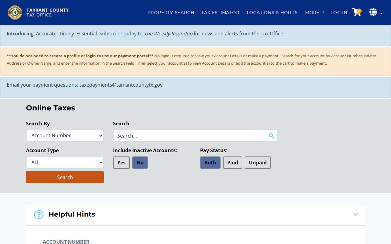
For a property address, the Tax Office advises entering the number and street name while leaving out a street type or direction. A mailing-address result can point somewhere else and should not overwrite the situs address.
Keller Streets Through GIS Layers
The Tarrant County Public Map Viewer searches by address, account, or owner and connects a map point to parcels, TAD, voter, and FEMA links. Use it to inspect the lots that front the same block, then click each official parcel detail rather than guessing from map proximity. Keller's landbase adds parcel, subdivision, street centerline, buildings, parks, schools, railroad, city-limit, ZIP-grid, TAD-grid, and Mapsco-grid layers.
Keller's street centerline has separate left and right values for ZIP and city. A road can therefore show a surprising postal or city label on one side. The TC911 address schema also stores house prefix, number, suffix, direction, street name and suffix, building, floor, unit, suite, room, ZIP, city, coordinates, and update fields. That layer normalizes an address string. It is not a roster of residents.
The county map viewer shows the parcel and layer controls used to place a Keller street address.
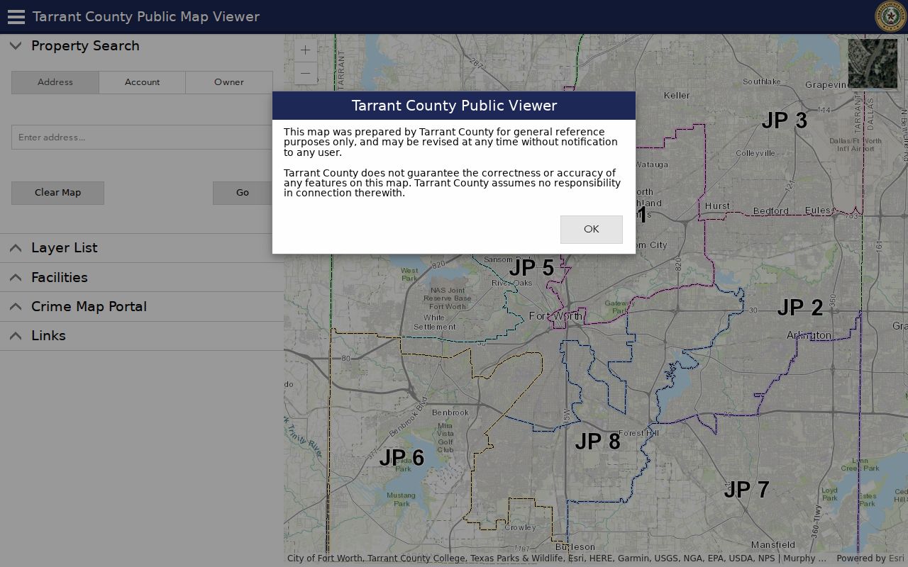
Capture the map date and legal description as you work. Adjacent on a map, within the same subdivision, and sharing a street name are different geographic relationships.
Keller Mailing and Situs Addresses
The most common street-directory mistake is merging an owner's mailing address with the property itself. TAD displays a primary owner address beside the property or situs address. Tarrant Tax treats Owner Address and Property Address as separate search modes. The first may return a location outside Keller, while the second ties the account to the physical parcel. Use both when a document's return address, tax mailing field, and map pin do not agree.
Legal description is the third check. A subdivision, block, lot, or abstract can survive a change in postal convention, unit styling, or street wording. Record it verbatim before comparing deeds or plats. A return address on a recorded instrument indicates where a document was sent, not necessarily the land that the instrument concerns.
Keller Records Found by Street
Address-keyed records form the working shelf behind a Keller street directory. The TAD card connects a parcel to appraisal data. Tax search adds payment-status and inactive-account controls. The County Clerk connects a legal description to documents. City eTRAKiT can add parcel, permit, inspection, case, and violation context. A postal result or address point helps normalize the location but does not identify a person.
| Address record | Keller street value | Keeper | Access |
|---|---|---|---|
| Appraisal account | Current owner, situs, legal description, subdivision | Tarrant Appraisal District | Public search |
| Tax account | Owner, mailing or situs address, payment and inactive controls | Tarrant Tax Office | Public search |
| Parcel map | Lots, map position, layers, nearby parcel context | Tarrant and Keller GIS | Public web map or REST layer |
| Recorded document | Grantor, grantee, legal description, instrument and dates | Tarrant County Clerk | Index, counter, online, or mail copy |
| Municipal parcel or case | Named contact, inspection, chronology, land-use context | City of Keller | eTRAKiT or public-information request |
A parcel is a mapped tract. A situs address is its physical location. A plat is the recorded map that lays out lots, blocks, and streets. These terms make a street-by-street record trail more dependable than a street-name search alone.
Keller Deeds Along a Street
Tarrant Official Records offers Quick and Advanced Search with a search term, recorded-date range, preset windows, and index-only or index-and-full-text OCR scope. A term can be a grantor, grantee, subdivision, document type, or document number. Index-only search treats two or more words as individual terms, while OCR is better for phrase or full-text work. A banner observed during research said the system was certified through August 27, 2026; its online historical start was not stated.
Open the document and record execution and recording dates, grantor, grantee, legal description, prior-instrument reference, restrictions or easements, and volume or clerk number where shown. Follow the prior reference backward. For 1876 through 1984, the deed history card system can be searched by subdivision, subdivision code, block, lot group, abstract, or grantee. Enter a grantee as LAST, FIRST; an abstract number is exact and does not take an A prefix.
The Official Records interface provides the grantor, grantee, subdivision, document, date, and OCR paths used for a Keller street chain.
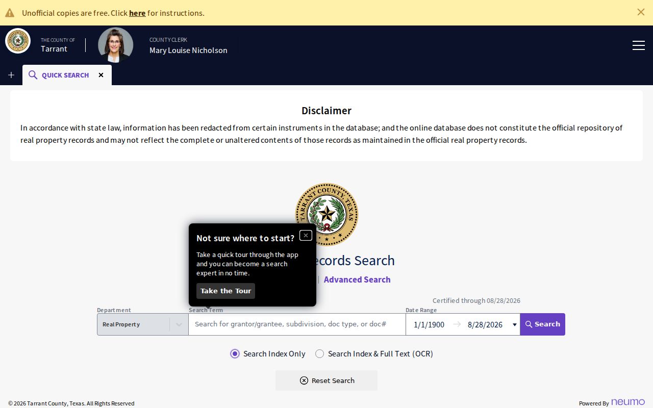
Free unofficial downloads require opening and signing in to the document; certified copies use a paid order. Clerk copies are also available at Room B30 or by mail with the document number and a stamped return envelope.
Note: A recorded deed documents an ownership event or interest, not who occupied a Keller address.
Keller Street Permit Context
Keller eTRAKiT has a parcel search with Search By, Search Operator, Search Value, and map controls. Its parcel results include Parcel Info, Owner Info, Restriction Details, Land Use, Building, Legal Desc, and Inspections. The companion case screen has Case Info, Site Info, Contacts, Fees, Inspections, Chronology, Violations, and Print. This gives a street directory search a municipal activity layer that property and deed records may not reveal.
Community Development handles permits, inspections, code compliance, and development-related records. The office's posted hours are Monday through Thursday, 7:30 to 5:30. A permit applicant or case contact is a role in that record, not proof of a household. If a visible portal entry is insufficient, ask the City Secretary for the existing record by describing the address, type, time period, and department.
Keller Street Document Copies
The County Clerk has more than one copy route when an online index is not enough. A visitor can use the public kiosk in Room B30 at 100 W Weatherford Street during the Clerk's weekday hours. A copy can also be ordered through the portal or by mail to County Clerk, Attn Room B30, with the document number and a self-addressed stamped envelope. The research records a copy charge of $1 per page and an additional $5 for certification; check current charges before ordering.
The real-estate recording notice lists $20 for the first page and $4 for each additional page, with a $10 notice-of-trustee-sale charge. Those recording amounts do not turn a plain index result into a title conclusion. Staff can explain the search tool, but the Clerk does not determine restrictions or perform a title or lien search.
Keller ZIP Lines on Streets
A Keller street directory can cross postal lines. Official map and GIS material shows 76244, 76248, and 76262 around Keller, while 76137 and 76180 are nearby boundary cases rather than confirmed Keller city-limit ZIPs. USPS remains the final address check. Its By Address mode uses street address, city, state, and an optional unit or ZIP; it standardizes a delivery line but does not confirm that a person or company is present there.
In 2009, USPS directed the last line Fort Worth TX 76244 for 17,500 deliveries that had used 76248. Preserve the original postal line on an older document. A different ZIP or city label can describe delivery geography, city limits, or one side of a road instead of a move.
Keller Street Directory History
For a past household, use a Fort Worth criss-cross directory only after checking its jurisdiction and suburban coverage. A criss-cross directory starts with an address and can list a historical name, telephone or business mark, edition, and page. Record the page and compare consecutive editions. The Fort Worth History Center reports such material in its genealogy holdings, though a complete volume-by-volume Keller inclusion list was not located.
Keller was previously called Double Springs and Athol. Its early record geography can be rural, postal, railroad, or county rather than municipal. Old street wording may also need a map, plat, City Secretary file, or archive comparison because a systematic official renumbering history was not located. The historical collection details belong with Keller city directories, while the present street-by-street chain remains here.
Keller Street Directory Limits
Address records have gaps by design. An appraisal owner is not always an occupant. A mailing address can be outside Keller. A map point can identify a unit or parcel without naming a resident. Voter privacy, the Texas Address Confidentiality Program, sealed court material, vital-record limits, and protected personal identifiers restrict what an official system displays. Do not try to infer a protected location from surrounding parcels or a suppressed record.
Lawful personal use. Use Keller street and parcel records for legitimate research, family history, property questions, or civic transparency. Never use a name or address trail to stalk, harass, intimidate, or harm someone.
Compare at least two independent sources, preserve their dates, and state the role actually shown. A careful street directory search is specific about its evidence and its limits.
When an address record is missing, use the access route tied to the record set. The Clerk offers the portal, counter, kiosk, and mail-copy options. Keller city material can be requested from the City Secretary with a record description and date range. Historical street questions may require the Archives, library microfilm, maps, or a reading-room search. A missing web result is a reason to change channels, not proof that the address or record never existed.